New Jersey braces for an impactful storm affecting all 21 counties, a state of emergency is in effect starting February 22nd at 12pm

New Jersey is bracing for a historic weather event beginning on February 22nd, 2026, with blizzard conditions along the shore and significant snowfall throughout the rest of the state. Safety is essential, and Gov. Sherrill has issued a state of emergency effective on February 22nd at 12 pm and set to expire when conditions are safe and improve. The governor met with five key members of the state in Mapleshade, NJ, today, issuing remarks on the Office of Emergency Management, NJ Transit, and updates on state infrastructure.
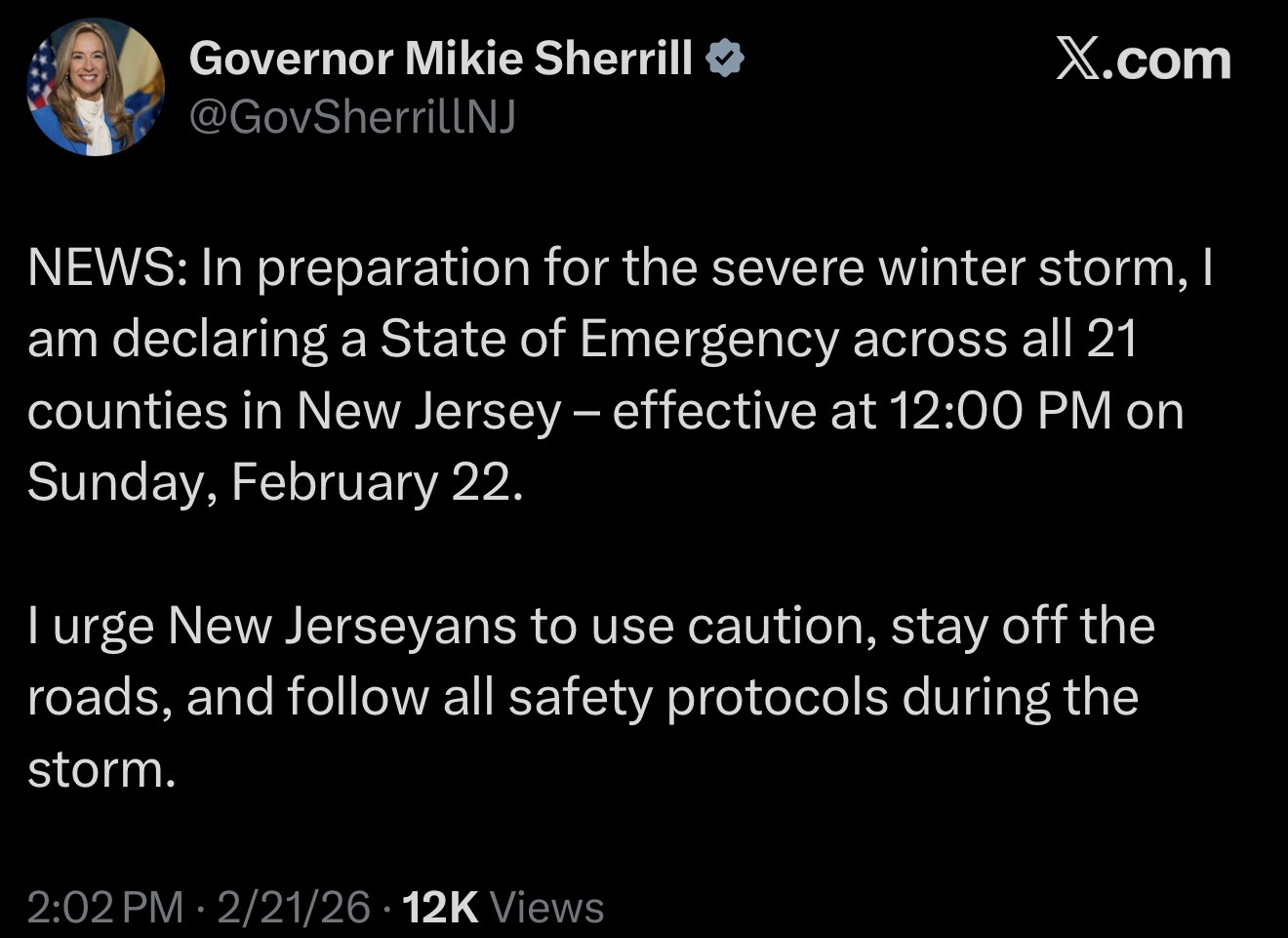
Governor Sherrill State of Emergency Press Release:
Key updates:
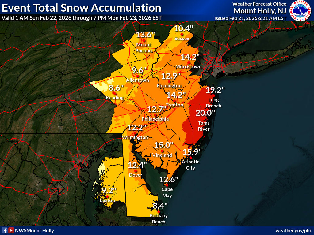
URGENT - WINTER WEATHER MESSAGE
National Weather Service Mount Holly NJ
154 PM EST Sat Feb 21 2026

BLIZZARD WARNING IN EFFECT FROM 10 AM SUNDAY TO 6 PM EST MONDAY (February 23rd 2026)

* WHAT...Blizzard conditions expected. Total snow accumulations
  between 16 and 20 inches. Winds gusting as high as 45 mph.

* WHEN...From 10 AM Sunday to 6 PM EST Monday.

* IMPACTS...Travel could be very difficult to impossible. Areas of
  blowing snow could significantly reduce visibility. The hazardous
  conditions could impact the Monday morning and evening commutes.
  Gusty winds could bring down tree branches.

PRECAUTIONARY/PREPAREDNESS ACTIONS...

Travel should be restricted to emergencies only. If you must travel,
have a winter survival kit with you. If you get stranded, stay with
your vehicle. The latest road conditions for the state you are
calling from can be obtained by calling 5 1 1.
The national weather service has issued severe warnings across the state due to the threat of life from the storm. All people are encouraged to shelter in place.
New Jersey Plotter:
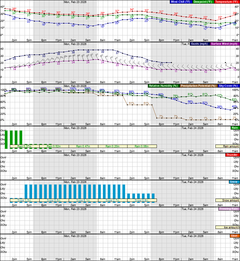
New Jersey Tabular Forecast:

Leave a Reply